Showing posts with label information graphics. Show all posts

Friday, December 16, 2011

Maps - Heights of Mountains, Lengths of Rivers

For over 100 years, atlas and map publishers in the United States and Europe published a style of map that was a visualization of the heights and lengths of the world's mountains and rivers. Some of the earliest examples appeared in Europe towards the end of the 18th century. In the United States, the form was popular throughout the 19th century and the early part of the 20th. These maps appeared in atlases, as wall maps, and as pocket maps. One of the most elegant examples was engraved originally on copper by map publisher Henry Tanner in Philadelphia in 1836 and then continued by S. Augustus Mitchell, also of Philadelphia, in lithographic versions into the 1850's.

The Mountains and Rivers maps appeared in several styles and formats. One of the earliest styles was to show just mountains, piled up in a landscape, with a key of mountain heights on the left and right sides of the illustration. Also listed on the side would be the highest flights of the Condor, limits of plants and trees, elevations of lakes, elevation of certain high altitude cites, and climate zones. An early example in the Rumsey collection is Charles Smith's Comparative View of the Heights of the Principal Mountains &c. In The World, published in London in 1816.

Another popular style combined heights of mountains and lengths of rivers in one view. The rivers are stretched out in single lines, with the longest on the left combining with the shortest mountains, while the shortest rivers combine with the highest mountains on the right. The visual result is very compelling. One of the earliest examples was W.R. Gardner's Comparative Heights of the Principal Mountains and Lengths of the Principal Rivers, published by William Darton in London in 1823.


A third variation of the mountain and rivers designs was putting the mountains in the center of the view with the rivers extending downward on each side. One of the earliest examples of this type was published by Henry Tanner in 1836, Heights of the Principal Mountains in the World.

John Dower and Henry Teasdale published another version in London in 1844 titled Principal Mountains and Rivers of the World. It is possible that there was an earlier version of this London map that Tanner copied from - a common practice of American mapmakers in the first half of the 19th century - but Tanner's map is centered on information important to American readers and the Dower/Teasdale map is oriented to England and Europe.

Gray's new map of the World in hemispheres, with comparative views of the heights of the principal mountains and lengths of the principal rivers on the globe, of 1885, provided a simplified view of the mountains and rivers. It appeared in George N. Colby's Atlas of the State of Maine, 1885.

Found Here: http://www.davidrumsey.com/blog/2009/9/5/heights-of-mountains-lengths-of-rivers


earliest known map is a matter of some debate, both because the definition of "map" is not sharp and because some artifacts speculated to be maps might actually be something else. A wall painting, which may depict the ancient Anatolian city of Çatalhöyük (previously known as Catal Huyuk or Çatal Hüyük), has been dated to the late 7th millennium BCE.[1][2] Other known maps of the ancient world include the Minoan "House of the Admiral" wall painting from c. 1600 BCE, showing a seaside community in an oblique perspective and an engraved map of the holy Babylonian city of Nippur, from the Kassite period (14th – 12th centuries BCE).[3] The oldest surviving world maps are the Babylonian world maps from the 9th century BCE.[4] One shows Babylon on the Euphrates, surrounded by a circular landmass showing Assyria, Urartu[5] and several cities, in turn surrounded by a "bitter river" (Oceanus), with seven islands arranged around it.[6] Another depicts Babylon as being further north from the center of the world.[4]

The ancient Greeks and Romans created maps, beginning at latest with Anaximander in the 6th century BC.[7] In the 2nd century AD, Ptolemy produced his treatise on cartography, Geographia.[8] This contained Ptolemy's world map - the world then known to Western society (Ecumene). As early as the 8th century, Arab scholars were translating the works of the Greek geographers into Arabic.[9]

In ancient China, geographical literature spans back to the 5th century BC. The oldest extant Chinese maps come from the State of Qin, dated back to the 4th century BC, during the Warring States Period. In the book of the Xin Yi Xiang Fa Yao, published in 1092 by the Chinese scientist Su Song, a star map on the equidistant cylindrical projection.[10][11] Although this method of charting seems to have existed in China even prior to this publication and scientist, the greatest significance of the star maps by Su Song is that they represent the oldest existent star maps in printed form.

Early forms of cartography of India included the locations of the Pole star and other constellations of use.[12] These charts may have been in use by the beginning of the Common Era for purposes of navigation.[12]Mappa mundi is the general term used to describe Medieval European maps of the world. Approximately 1,100 mappae mundi are known to have survived from the Middle Ages. Of these, some 900 are found illustrating manuscripts and the remainder exist as stand-alone documents.[13]

The Arab geographer Muhammad al-Idrisi produced his medieval atlas Tabula Rogeriana in 1154. He incorporated the knowledge of Africa, the Indian Ocean and the Far East, gathered by Arab merchants and explorers with the information inherited from the classical geographers to create the most accurate map of the world up until his time. It remained the most accurate world map for the next three centuries.[14]

In the Age of Exploration, from the 15th century to the 17th century, European cartographers both copied earlier maps (some of which had been passed down for centuries) and drew their own based on explorers' observations and new surveying techniques. The invention of the magnetic compass, telescope and sextant enabled increasing accuracy. In 1492, Martin Behaim, a German cartographer, made the oldest extant globe of the Earth.[15]

Found Here: http://en.wikipedia.org/wiki/Cartography


Tuesday, June 28, 2011

Denderah Zodiac from the Temple of Hathor

The temple to Hathor at Denderah, Egypt was constructed as a monument and a learning venue for Motherhood. The design of the monument carries the celestial theme throughout its grand architecture. Within each chamber and hall are magnificent and profound works of art which glorify the qualities of benevolent motherhood. In the entrance areas are fully inscribed columns with the Nile Lotus replaced by the head of Hathor wearing her traditional wig over cow ears. The temple is the product of the Hellenistic Period after the conquests of Alexander the Great during the Ptolemaic Dynasties, just prior to, and overlapping the initiation of the Christian era.. The Nile Lotus and the Wig of Hathor are both symbols of the object held in the hand of the constellation Virgo. Modern astronomers recognize the wig as Coma Berenices; the wig of Berenices. However it should be self evident that the stars at the top of the axis of the galactic sphere can be connected to look like a sprig of wheat, an ear of corn, a Red Pandanus, a Nile Lotus, an Indus Lotus, or any fertile flower. The essence of a fertile flower is the theme of the temple to Hathor, and the essence of benevolent motherhood. This essence is drawn directly from the positions of the stars at the top axis of the galactic plane of the Milky Way, perceived from earth.

In the ceiling of the Osiris chamber the architects installed a cosmic story about the deflowering of motherhood. The story was told as a prophecy, and an example teleology; the belief that design and purpose are apparent in nature. It is derived from the Egyptian record of the experiences of life, and their recorded knowledge of the most ancient traditions of the whole world. It is the quintessential document which relates to the conversation between the Egyptian priest and Solon in Plato's dialogue by Critias. For the monument reads like a history book, in which the clock of the heavens defines the space-time frame, and the rhythm of Plato's Dance of the Gods. Besides a history of the ancient world, the monument tells a story about the maturation cycle of human souls in the whole of Western Civilization for an additional 8600 years to come. The solar eclipse of August 1999 demonstrates that the great accuracy of the celestial knowledge of the temple architects included dramatic teleological aspects. Within the presentation of their material science, the spiritual message of the Egyptian priests and priestesses is clearly visible. It is a story about love and reason, arrogance and wisdom, banishment and salvation. Most of all, it is a story about a man child (Horus) and his mother (Hathor), and the dialog of mankind with the Creator.

This is the Greatest Story Ever Told. It has been told around the world. In Polynesian traditions it is the legend of the Land Under the Land, where a disenchanted wife meets a stranger and goes to the Land of Shadows to have her husband's child before returning to the top of the world with peace in her heart, and a Red Pandanus in her hand. In Mesoamerica it is the legend of Hanahpu and his brother Xbalanque. In Mesopotamia it is the legend of Gilgamesh and Enkidu, among many others. In India it is the dance of Shiva. In China and east Asia, it is the dance of the Sun Dragon. The Bible tells the same story with many different players, including Adam and Eve, Isaac and Ishmael, Aaron and Moses, John and Jesus, and the Child of the Madonna. On August 11, 1999, the sun winked as it entered into the Kingdom of Heaven. To let this incredibly important moment pass without recognition of its historical value would be a sacrilege against all that has been sacred since the beginning of the dialogue between man and Creator. For, to be silent is repression. Thus, this story is being told in the hopes that a modern world is not so cosmically deaf that it has lost all value in its ancient sacred meaning.

COMMON SENSE IS INTUITIVE

The reason why so many of the world's sacred myths have a familiar ring to them is the fact that they were all taken from the same patterns in the stars. To say that the stars contain Plato's Lost Island of Atlantis would not be an exaggeration, for the stars contain all the lost legends of our past. The legends are all testaments to the observational brilliance that accumulated at the predawn and early dawn of civilization. They are the foundations of our modern Jungian archetypes. Within these great legends is an unmistakable common belief in the benevolence of Mother Nature. It is the trust and faith that humans gave to Mother Nature that caused her to be deflowered as Western Civilization became a domain of the rule of law. Civilization is not to blame for her being deflowered. It is a process which humanity must pass through. Mother Nature deflowered herself so that the man child could grow to full maturity. The stranger she had come to know was the rationalizing husband and the immature son that she loved so dearly. They had forgotten her value as the vessel of life. In her own words, as spoken through her son, we find the echo of all the great legends.

John 14:1-3
1 Let not your heart be troubled: ye believe in God, believe also in me.
2 In my Father's house are many mansions: if it were not so, I would have told you.
I go to prepare a place for you.
3 And if I go and prepare a place for you, I will come again, and receive you unto myself;
that where I am, there ye may be also.

The deflowering of motherhood is the essential path which all children must follow, sooner or later. For you see, it is not the mother's body that is deflowered, it is the ideal of the goddess she represented when we were young. Our rational mind searches for scientific truth, in the hope that one day we can be independent of the myths we learned within the mothering bonds that we hold in the memories of our youth. When we finally reach the end of our adolescent umbilical cord, it breaks, and we search for the mothering bonds to find out what went wrong. As we turn back, we can become a "pillar of salt" and lose all emotional bondage, or we can shed the tears of our temporal identity and be grateful that the Cosmos was willing to give us mothering when it was needed. After the bond is broken, it can be restored again by the simple grace of gratitude. Then we become wise and are capable of passing on to those who follow us, the stories we once believed to be the material and maternal facts of life. At the end of our mother's cord we learn that she had prepared us to break the bondage of the rational umbilical cord, which was our dream of her divine nature. A few years wandering in the wilderness is all that any rational person needs to recognize that we do not live in a world dominated by the rational ideas of men, we live in a world bound to the breast of Mother Nature. We cannot break that bondage by death. We can only stress and distort it by denial during life.

Hidden behind the logic of this microscopic maturation cycle of a single human soul is the macroscopic maturation cycle of civilizations. Like individuals, civilizations strive to break the umbilical bondage. And like individuals, health is restored when a civilization recognizes that Mother Nature knows only Tough Love. She gives us a scepter of flint as proof that we are capable of self inspiration when we walk in the pits of our emotions. She gives us a flail as proof that we can overcome physical stress. She gives us a crook as proof that we can lead others to the Promised Land. And last, she gives us a door through which we can pass a material record of our lives on to her children who come after us. In Egypt the door was Rostau, where Osiris ascended to Orion, and the Great Pyramids promised his return. It is through that door that the present essay will lead. The metaphor of the way of the door has been fabricated many times and in many ways. The ceiling monument in the chapel to Osiris is a detail of Mother Nature's passages through the cosmic door into the mystery of the heavens.|

Read More Here: http://www.siloam.net/cornwall/cornwal4.htm
Denderah Zodiac
S. Battaglia, G. Miglietta and Opera Laboratori Fiorentini

Full scale reproduction of the Zodiac from the Temple of Hathor in Denderah, the first depiction of the heavens in which use is made of stereographic projection. The outermost circle shows 36 decans, each scanning a 10-day interval; the first decan is level with Sirius, the star that heralds the beginning of the year and the arrival of the Nile flood. The second circle shows the constellations in the southern hemisphere. The third circle shows the constellations in the northern hemisphere. The figures of the Zodiac are aligned along the eccentric circle of the ecliptic. The axis joining Cancer to Capricorn (the solstices) points in a north-south direction. The temple's transverse axis is perfectly oriented towards the heliacal rising of Sirius, which rose at 18o east-southeast. Sirius, portrayed as a squatting cow, is correctly shown at the point of maximum culmination on the celestial meridian of the southern hemisphere.

Found Here: http://brunelleschi.imss.fi.it/galileopalazzostrozzi/object/DenderahZodiac.html
History

During the Napoleonic campaign in Egypt, Vivant Denon drew the circular zodiac, the more widely known one, and the rectangular zodiacs. In 1802, after the Napoleonic expedition, Denon published engravings of the temple ceiling in his Voyage dans la Basse et la Haute Egypte.[4] These elicited a controversy as to the age of the zodiac representation, ranging from tens of thousands to a thousand years to a few hundred, and whether the zodiac was a planisphere or an astrological chart.[5] Louis Charles Antoine Desaix, a member of the expedition, decided to remove the relief to France and so, in 1820, the antiquities dealer Sébastien-Louis Saulnier commissioned Jean Baptiste Leloraine, a master mason, to remove the circular zodiac with saws, jacks, and scissors constructed for the job. The zodiac ceiling was moved in 1821 to Restoration Paris and, by 1822, was installed by Louis XVIII in the Royal Library. In 1964, the zodiac moved from the Bibliothèque Nationale to the Louvre.

The controversy around the zodiac, called the "Dendera Affair", involved people of the likes of Joseph Fourier (who estimated that the age was 2500 BC[6]), Thomas Young, Jean-François Champollion, and Jean-Baptiste Biot.[7] Johann Karl Burckhardt and Jean-Baptiste Coraboeuf held, after analysis of the zodiac, that the ancient Egyptians understood the precession of the equinoxes. Champollion, among others, believed that it was a religious zodiac. Champollion deciphered the names of Tiberius, Claudius, Nero and Domitian on the ceiling of Dendera's temple, and placed the zodiac in the era of Roman rule over Egypt.[8] Baron Georges Cuvier placed the date 123 AD to 147 AD.[9] His discussion of the dating question is an interesting summary of the reasoning as he understood it in the 1820s.

Over the last 10 years, I have been presented with a star-code science called cosmogenesis. From 2000 July 17th to 2007 July 17th a pattern of psycho-physical reference points to astronomical events were presented over and over again to engage and synchronize my attention to the placement the Egyptian’s called Heaven’s Gate: The Cancer-Leo Boundary. The code cosmogenesis uses to construct meaning is based on an epistemology designed by the Egyptian Cosmologists. For the sky-priests who closed the Egyptian Empire’s Old World Order, they designed an ingenious calendar wheel at the Temple to Hathor was called the Denderah Zodiac. I made it my concern to follow the on-line study of this remarkable cosmology with the help of Rush E. Allen an engineer and astro-archaeologist whose mentorship provided me the firing-pins for walking the path of the True Priest.

To present the revelation of the Little Lion, we will walk through the basics of Egyptian Cosmology. The modus operandi for their vision of reality is not unlike that of the modern sages like Einstein, Podolsky and Rosen who argued that a quantum state corresponds not to reality but to the information we have about a subsystem of the universe. The quantum state for The Egyptian sky-priests who authored the science accepted two fundamental bodies of knowledge. One was called the Horus of the Two Horizons and the other was Coming Forth By Day, or the study of the First Fire Ceremony. Between these two pillars of science did the Egyptian cosmologists attempt to construct based on information gathering how the planets, milky way and stars were set to the house of creation that made room for one very unique ally in creation: man and his perception of self within a living system. The D.Z. concretized all these aspects with one important axiom. To acquire the experience of Truth one must suffer the burden of cosmic responsibility once he has put his ‘feelings straight’.

A scientific paper was presented during the time of Seti I to define the ability to understand the science of predicting outcome. The Hunefer Papyrus was the Occam’s Razor of the 17th Dynasty.

Found Here: http://www.cyberspaceorbit.com/Lion/Lions_Gate_July_17.htm

The Hidden Geometry of the Zodiac in the Temple of Hathor, Denderah
1. The eight Horus figures holding the circle of the heavens define a pair of crossed axes by the lines defined by knees and elbows. 2. A hexagram may be drawn in by joining the points where the Isis figures hands meet on the circumference of the circle. 3. A pair of horizontal lines are drawn as shown by connecting the "shoulders" of the Horus figures, then point where their headresses terminate. These lines occur at the correct location to each form one side of the regular pentagram which can be inscribed in the circle. Thus two pentagrams are formed; one upright and one inverted. 4. With the remaining lines of the pentagrams drawn in, confirming proof that these constructions represent the intent of the designers is provided by the placement of the straight lines which connect the two fishes of Pisces. Note how one of these two lines not only forms a small section of the side of the pentagram itself, but occurs at the point where this line is intersected by the horizontal diameter of the circle.

Related Pages:

Hidden Geometry in Art:
Pierro Della Francesca:
Fra Angelico
Fra Luca Pacioli
Denderah Zodiac

Geometrical Analysis of the East Meon Crop Circle

Etheric technology of ancient Egypt: The Temple of Hathor at Denderah

Original Article Found Here: http://www.russwill.com/experiments/astro/Denderah/hidden_geo/geo_zodiac.htm

Thursday, May 19, 2011

Azoth of the Philosophers

“Visita Interiora Terra Rectificanto Inveniens Occultum Lapidem”

L’Azoth des Philosophes, Basil Valentine, Paris, 1659.

For more than 350 years, this image of the Azoth has been used by alchemists as a meditative mandala because it is believed to contain all the essential components of the Great Work.

Over the next eight weeks we are going to explore the elements of this alchemical mandala to discover a personal and powerful meditative process for using it to acquire an in depth understanding of the the seven key processes for creating the Philosopher’s Stone as well as participating in an initiation into a hermetic perspective that will enrich your life in ways that you have not yet imagined.

There are many explanations of the Azoth available on web sites and in numerous writings. However, I suggest you establish your own relationship with the Azoth before reading the interpretations of others. Spend personal time with the image during the next week identifying the messages it holds for you and developing your unique and special understanding of its symbols before listening to what I and others have to say about this eternal hermetic symbol.

Then each week for seven weeks we will examine in depth through a variety of methods the steps revealed in the Azoth for creating the Stone.

I look forward with excitement and expectation for participating with you in this ancient alchemical practice that will have a lasting impact on your life.

Found Here: http://ouroboroscycle.com/blog/?p=473

Interpretation of Azoth of the Philosophers (by Dennis William Hauck)

This meditative emblem first published in 1659 as an illustration for the book Azoth of the Philosophers by the legendary German alchemist Basil Valentine. The word "Azoth" in the title is one of the more arcane names for the One Thing. The "A" and "Z" in the word relate to the Greek alpha and omega, the beginning and end of all things. The word is meant to embrace the full meaning of the One Thing, which is both the chaotic First Matter at the beginning of the Work and the perfected Stone at its conclusion.

At the center of this striking drawing is the face of a bearded alchemist at the beginning of the Work. Like looking into a mirror, this is where the adept fixes his or her attention to meditate on the mandala. Within the downward-pointing triangle superimposed over the face of the alchemist is the goal of the Work, the divine man in which the forces from Above and Below have come together. Each of the sequentially numbered points on the star emanating from the alchemist stands for an operation in the Emerald Formula (Calcination, Dissolution, Separation, Conjunction, Fermentation, Distillation, and Coagulation) and contains the cipher for the corresponding metal. To see an explanation of these operations, click on the appropriate point on the star.

The alchemist’s schematized body is the offspring of the marriage between Sol, the archetypal Sun King seated on a lion on a hill to his right, and Luna, the archetypal Moon Queen seated on a great fish to his left. "Its father is the Sun," says the tablet, "its mother the Moon." The laughing, extroverted Sun King holds a scepter and a shield indicating his authority and strength over the rational, visible world, but the fiery dragon of his rejected unconscious waits in a cave beneath him ready to attack should he grow too arrogant. The melancholy, introverted Moon Queen holds the reins to a great fish, symbolizing her control of those same hidden forces that threaten the King, and behind her is a chaff of wheat, which stands for her connection to fertility and growth. The bow and arrow she cradles in her left arm symbolize the wounds of the heart and body she accepts as part of her existence. In simplest terms, the King and Queen represent the raw materials of our experience -- our thoughts and feelings -- with which the alchemist works.

The King symbolizes the power of thought, ultimately the One Mind of the highest spirit. The Queen stands for the influence of feelings and emotions, which are ultimately the chaotic One Thing of the greater soul. The much anticipated Marriage of the King and Queen produces a state of consciousness best described as a feeling intellect, which can be raised and purified to produce a state of perfect intuition, a direct gnosis of reality. "All Obscurity will be clear to you," says the tablet of this state of mind; it is "the Glory of the Whole Universe." The goal of alchemy is to make this golden moment permanent in a state of consciousness called the Philosopher’s Stone, and it all starts with the marriage of opposites within us.

In our drawing, the body of the alchemist is composed of the Four Elements. His feet protrude from behind the central emblem; one is on Earth and the other in Water. In his right hand is a torch of Fire and in his left a feather, symbolizing Air. Between his legs dangles the Cubic Stone labeled with the word Corpus, meaning body. The five stars surrounding it indicate that it also contains the hidden Fifth Element, the invisible Quintessence whose "inherent strength is perfected if it is turned into Earth." Where the head of the alchemist should be, there is a strange winged caricature that is variously interpreted as a heart, a helmet, or even the pineal gland at the center of the brain. The symbol evolved from the Winged Disk of Akhenaten and became the top of the Caduceus, the magical wand of Hermes where opposing energies merge to produce miracles. This knob represents the Ascended Essence, the essence of our souls raised to the highest level in the body, to the brain, where it becomes a mobile center of consciousness able to leave the body and travel to other dimensions.

Touching the wings of the caduceus are a salamander engulfed in flames on the left side of the drawing and a standing bird on the right. Below the salamander is the inscription Anima (Soul); below the bird is the inscription Spiritus (Spirit). The salamander, as a symbol of soul, is attracted to and exposed in the blazing fire of the Sun. Likewise, the bird of spirit is attracted to the coolness of the Moon and is reflected in it. This is a subtle statement of the fundamental bipolar energies that drive the alchemy of transformation. Spiritus, Anima, and Corpus form a large inverted triangle that stands behind the central emblem. Together they symbolize the three archetypal celestial forces that the alchemists termed Sulfur, Mercury, and Salt. Again, these chemicals are not chemicals at all, but our feelings, thoughts, and body.

- from THE EMERALD TABLET (Penguin 1999) by Dennis William Hauck

Found Here: http://www.alchemylab.com/azoth.htm

Wednesday, January 5, 2011

Rongorongo Writing - Easter Island


THE TABLET WRITING OF ANCIENT TIMES
The Deniart RongoRongo series contains 292 unique symbols based on the inscriptions found on ancient tablets from Easter Island.

Many attempts have been made to decipher the script and efforts are continuing to this day. Unlike many writing systems of ancient times, rongorongo is a mixed script, not an alphabet nor a syllabic script.

There are approximately 120 basic rongorongo glyphs and these basic glyphs (main signs) are then affixed (prefixed, infixed, and suffixed), fused (one glyph atop another), and compounded. A "normal rongorongo glyph" can be a mixture of any of these. Each affix, for example a basic glyph of a person in a given position, like a arm pointing in a given direction, adds a different meaning and may change given the context in which it is positioned. As such, it can be said that there may be an almost indefinite number of combinations which in turn may give an indefinite number of meanings and we are not able to provide a translation guide at this time due to these complexities.

Found Here: http://www.deniart.com/rongo.shtml

The famous Moai (big brooding stone statues) are amazing. An island population, which probably never exceeded 15000 people, carved over 1000 of them and erected them all round the coast on straight stone platforms overlooking the villages (their backs to the sea). With their huge red topknots and staring white coral and black obsidian eyes, the villagers can never have forgotten that their important ancestors were watching them! The biggest Moai is 21m tall and weighs about 250 tons but was probably too big to move without metals or animals and still lies in the quarry. Another, 10m tall and over 90 tons is amongst those which have recently been re-erected, but a huge modern crane was imported for the job. The ancient Rapa Nui people also developed a form of writing rongorongo) which has still not been deciphered as only a few examples carved on wooden tablets have survived. Alas, the moais got too many and too big; all the island trees were cut down for statue transport and the culture came to an abrupt end with civil war and the deliberate casting down of almost all the statues just before the first European visitors in 1722. Later, slavery and smallpox reduced the Rapa Nui people to just a few hundred but before that, in the 18th and 19th centuries, the "bird-man" cult flourished as the petroglyphs and reconstructed dwellings at Orongo bear witness.

Ed: The symbols on the Rongorongo include a fascinating multitude of little figures of men in a variety of positions, flying birds, animals, and what appear to be plant, celestial objects, and geometrical forms. They are complex in detail yet at the same time drawn with calligraphic flow. There are hundreds of different signs - far too many to suggest any sort of phonetic alphabet.

Found Here: http://www.zoro.co.uk/Page5/Sth%20Pacific4.html

Rongorongo (pronounced /ˈrɒŋɡoʊˈrɒŋɡoʊ/ in English, [ˈɾoŋoˈɾoŋo] in Rapa Nui) is a system of glyphs discovered in the 19th century on Easter Island that appears to be writing or proto-writing. It cannot be read despite numerous attempts at decipherment. Although some calendrical and what might prove to be genealogical information has been identified, not even these glyphs can actually be read. If rongorongo does prove to be writing, it could be one of as few as three or four independent inventions of writing in human history.[note 1]

Two dozen wooden objects bearing rongorongo inscriptions, some heavily weathered, burned, or otherwise damaged, were collected in the late 19th century and are now scattered in museums and private collections. None remain on Easter Island. The objects are mostly tablets shaped from irregular pieces of wood, sometimes driftwood, but include a chieftain's staff, a bird-manreimiro ornaments. There are also a few petroglyphs which may include short rongorongo inscriptions. Oral history suggests that only a small elite was ever literate and that the tablets were sacred. statuette, and two

Authentic rongorongo texts are written in alternating directions, a system called reverse boustrophedon. In a third of the tablets, the lines of text are inscribed in shallow fluting carved into the wood. The glyphs themselves are outlines of human, animal, plant, artifact and geometric forms. Many of the human and animal figures, such as 200 Rongorongo glyph 200 and 280 Rongorongo glyph 280, have characteristic protuberances on each side of the head, possibly representing ears or eyes.

Individual texts are conventionally known by a single uppercase letter and a name, such as Tablet C, the Mamari Tablet. The somewhat variable names may be descriptive or indicate where the object is kept, as in the Oar, the Snuffbox, the Small Santiago Tablet, and the Santiago Staff.

Found Here: http://en.wikipedia.org/wiki/Rongorongo

Tuesday, November 30, 2010

Kryptos - Jim Sanborn

It is perhaps one of the C.I.A.’s most mischievous secrets.

“Kryptos,” the sculpture nestled in a courtyard of the agency’s Virginia headquarters since 1990, is a work of art with a secret code embedded in the letters that are punched into its four panels of curving copper.

“Our work is about discovery — discovering secrets,” said Toni Hiley, director of the C.I.A. Museum. “And this sculpture is full of them, and it still hasn’t given up the last of its secrets.”

Not for lack of trying. For many thousands of would-be code crackers worldwide, “Kryptos” has become an object of obsession. Dan Brown has even referred to it in his novels.

The code breakers have had some success. Three of the puzzles, 768 characters long, were solved by 1999, revealing passages — one lyrical, one obscure and one taken from history. But the fourth message of “Kryptos” — the name, in Greek, means “hidden” — has resisted the best efforts of brains and computers.

And Jim Sanborn, the sculptor who created “Kryptos” and its puzzles, is getting a bit frustrated by the wait. “I[..]umed the code would be cracked in a fairly short time,” he said, adding that the intrusions on his life from people who think they have solved his fourth puzzle are more than he expected.

So now, after 20 years, Mr. Sanborn is nudging the process along. He has provided The New York Times with the answers to six letters in the sculpture’s final passage. The characters that are the 64th through 69th in the final series on the sculpture read NYPVTT. When deciphered, they read BERLIN.

But there are many steps to cracking the code, and the other 91 characters and their proper order are yet to be determined.

“Having some letters where we know what they are supposed to be could be extremely valuable,” said Elonka Dunin, a computer game designer who runs the most popular “Kryptos” Web page.

None of this was really envisioned when the Central Intelligence Agency planned the expansion known as the New Headquarters Building in the 1980s and asked artists to submit proposals to create a work of art for the courtyard. The broad principles it provided for the $250,000 commission included the notion that it should “engender feelings of well-being, hope.”

The winner was Mr. Sanborn, and the agency introduced him to Edward Scheidt, a retiring C.I.A. cryptographer, who gave him a crash course in the arts of concealing text and helped devise the codes used in the sculpture.

One reason the fourth puzzle has proved so difficult is because, with just 97 characters, it is shorter than any but the first. Longer chunks of text are easier to crack because there is more information to study for patterns.

The messages form the two left-hand panels of the sculpture’s wall of text; the other two panels on the right side provide the key to cracking some of the text. Each is encrypted in a different way from the others.

The first reads: “Between subtle shading and the absence of light lies the nuance of iqlusion.” (Mr. Sanborn admitted to introducing misspellings to add a degree of difficulty.)

The second passage includes the latitude and longitude of the C.I.A.’s headquarters and asks, “Does Langley know about this? They should: it’s buried out there somewhere. X Who knows the exact location? Only WW.”

This is a reference to William Webster, the former C.I.A. chief — Mr. Sanborn gave him a key to deciphering the messages.

The third passage paraphrases, with an intentional misspelling, the account of Howard Carter, the renowned Egyptologist, as he opened King Tut’s tomb. Mr. Sanborn has said the passage has inspired him since childhood.

“Slowly, desparatly slowly, the remains of passage debris that encumbered the lower part of the doorway was removed. With trembling hands I made a tiny breach in the upper left-hand corner. And then, widening the hole a little, I inserted the candle and peered in. The hot air escaping from the chamber caused the flame to flicker, but presently details of the room within emerged from the mist. x Can you see anything? q”

Though “Kryptos” has long been famous in code-busting circles, it gained wider notoriety when Mr. Brown slyly referred to it on the dust jacket of his best-selling novel “The DaVinci Code” and incorporated it into the plot of “The Lost Symbol.”


While many artists might be thrilled with such publicity, Mr. Sanborn was deeply irked by the way his work was portrayed as a possible key to “ancient Masonic secrets” in “The Lost Symbol.”


“As far as I’m concerned, he did me no favors,” Mr. Sanborn groused about Mr. Brown.

The message of his artwork, and its relevance to the C.I.A., is more nuanced than a plot point in a potboiler novel, he said.

“Anybody holding a secret has a position of power, even if it’s a trivial secret,” Mr. Sanborn said.

To code breakers, Mr. Sanborn, not the C.I.A., is in the real position of power. They e-mail him. They call him. Some have produced papers of 100 pages or more explaining their theories on the final 97 characters. “In their world, a complete tour de force,” said Mr. Sanborn, save for one thing: “It doesn’t have anything to do with ‘Kryptos.’ ”

He likes and respects many of the fans. But some others? “Certifiable,” he said.

Recently, one even showed up in the front yard of his home on an island in the Chesapeake Bay, brandishing a three-ring binder that she was convinced contained the answer. It did not.

He has asked a friend — Mr. Sanborn has given him some of the answers, but not all — to handle inquiries from those who say they have solved the puzzle.

“My friend says, ‘What do you have in letter-position 27?’ ” Mr. Sanborn explained. “If that’s not the same letter, ‘Game over, and you didn’t crack the code.’ ” (He recently set up a Web site to take submissions automatically.)

So far, no one has had more than two letters right, though some dispute this. “They say, of course I cracked the code — who are you to say I didn’t crack the code?” Mr. Sanborn said. Some of them even suggest that he does not know the answer himself.

He hopes others will hurry up and solve it.

“I can’t do this for many more decades, O.K.?” Mr. Sanborn said. “I’m 65 now. They might get some more clues at 75. But 85?”

Found Here: http://slumz.boxden.com/f5/nov-22-can-you-crack-c-i-s-kryptos-code-1451559/

Mystery Crypto Letter Has Coders Stumped

A coded letter sent last year to the Fermi National Accelerator Laboratory in Illinois has the lab, and outside coders stumped. The letter was sent anonymously last March in a hand-addressed envelope via regular mail to the physics lab’s public affairs office.

After sitting on the letter for more than a year, the lab posted it on a physics blog in May, hoping to get help cracking it.

Thousands of sleuths have taken a stab at it so far and have succeeded to crack two parts of the letter. An engineer at the Canadian Space Center used a variation of the base-3 system to uncover a line that reads “Frank Shoemaker would call this noise,” which refers to an 86-year-old retired Princeton University physicist who helped design the magnets used with the lab’s first particle accelerator, known as the Main Ring. Another line in the letter has been cracked to read, “Employee number basse sixteen.”

A Chicago Tribune story about the letter offers some possible explanations behind the two sentences and what appears to be a typo in the second sentence.

But, like the famous CIA Kryptos sculpture (which also has a typo), one final section of the letter (pictured above) remains unsolved. The lab is hoping outsiders will help them unravel the clues. You can see the entire letter on the physics blog where it was posted. An undated update to the blog post indicates that they suspect they now know who may have sent the letter.

Coders post your solutions in the comments section below or send them directly to me (you’ll find my e-mail address in this blog’s righthand column) with an explanation about how you cracked it.

Found Here: http://www.wired.com/threatlevel/2008/07/mystery-at-ferm/

Jim Sanborn

Jim Sanborn has had work exhibited at the High Museum of Art, the Los Angeles County Museum of Art, the Phillips Collection and the Hirshhorn Museum. He has been commissioned to create artwork for such sites as the Massachusetts Institute of Technology, the Central Intelligence Agency and the National Oceanic and Atmospheric Administration.

Sanborn was born in 1945 in Washington, D.C. His father, a print maker, was the Director of Exhibitions at the Library of Congress for 30 years. His mother was a pianist and photo researcher. Sanborn grew up in Alexandria, Virginia, attended JEB Stuart High School in Fairfax, and went on to study archaeology and Romanesque cathedrals. He studied archaeology at Oxford University, and received a Bachelor of Arts degree in paleontology, fine arts, and social anthropology in 1968 from Randolph-Macon College in Ashland Virginia, and a Master of Fine Arts degree in sculpture from Pratt Institute in Brooklyn in 1971. He taught at Montgomery College in Rockville, and for nine years was the artist-in-residence and taught classes at Glen Echo Park. He has also traveled extensively in Asia, and in 1983 was commissioned to install a piece in Japan.

Mr. Sanborn is noted for his work with American stone and related materials that evoke a sense of mystery and the forces of nature. He is probably best known for the "Kryptos" sculpture installed at CIA Headquarters in 1990, which displays encrypted messages which continue to stump code-breakers to this day.

Sanborn contact info: This website is not directly associated with Mr. Sanborn.

Found Here: http://elonka.com/kryptos/sanborn.html

Wednesday, November 17, 2010

Annunaki Hieroglyphics - New Jersey Coast


Canal Complexes in America .................. This site is a review of some empirical evidence that will forever change the history of pre-diluvial America, shifting our paradigm from what we think we know about America to a whole new standard of 'Truth' about pre-historic civilizations on the North American continent.

Ancient Cities on our Coasts .... ...... .... .There are hundreds of miles of coastline, from Maine to Florida, continuing across the Gulf States including Texas and parts of Mexico, that are covered with vestiges and remnants of a very sophisticated, enormously large water borne culture or civilization that existed BEFORE current sea level rose an average of 12 to 25 feet, or more.

Sophisticated Geo Engineers: Add Image The evidence you are about to see, shows nearly every swampy piece of marsh land on most of the Eastern US Coast and Gulf of Mexico, to have been 'worked' and 'inhabited' by a very large, very sophisticated population of canal builders during some remote pre-flood period.

Found Here: http://www.ancientcanalbuilders.com/index.html

I was perusing the site Ancient Canal Builders Dot Com and came across these incredible hieroglyphics on Marshelder Island, New Jersey. The site is focusing on ancient coastal canals and it is clear that drainage canals and canals for other purposes were cut into almost the entire east coast of the United States. Now you do not need ETs or Atlanteans to explain them. Clearly, without any documents detailing this work, it predates 'history' and therefore could have been done by anyone, almost. I say almost because one section of the canals are not canals but lines defining various messages.

Now I do know about you, but if you have ever been in a salt marsh, the idea of creating a canal is a monumental task. The water table comes right up to the base of the marsh plants, and is a spongy, soft, wet mess to try to cut into. Even if you remove some of the mats of vegetation and the mud, just to put it into a wheelbarrow makes the wheelbarrow too heavy to move, as the wheels sink into the muck, that is, if you could even get a wheelbarrow into the area to begin with. In Louisiana, at the mouth of the Mississippi, huge canals, thousands of miles of them, were cut by floating barges starting in open water and cutting and dredging their way into areas where drilling for oil would occur. So the task in Mississippi required massive machinery and the canals all connect to deep water where the machinery came from.

So you see from the attached photos that we could have a similar explanation for these ancient canals. Whether that is actually the explanation for these ancient canals is another matter.

But all of a sudden if you zoom in on Google Earth, you see hieroglyphs set into lines with Sumerian measurements. Not to say the Sumerians made the lines, but what is that between the lines? It is hieroglyphs of a type not known previously. As far as I know, there is no interpretation of what these say, nor is there any expert who was ever aware of, studied, or made conclusions about them. Perhaps the messages are in Sumerian. Perhaps they predate the Sumerians, as Sumeria or Sumer is dated to 5,000 years ago. But Sumerian tablets describe the Annunaki, Niburu and mining for gold and creating us as slaves, going back a million years. You would know this if you have read any of the recently deceased Zecharia Sitchin books about what those tablets say, including "The Twelfth Planet" and seven more volumes after that, available in paperback. How old are these messages, and can we preserve them for study? Very old and no.

Even without pole shift, these areas are about to be submerged from rising ocean levels. Count in pole shift where all of New Jersey is about to go under water permanently, and you can see there is no likelihood of this becoming the national park it really should be. Just as Nazca has been featured in the history channel series "Ancient Aliens" and is the best known proof of ET presence on Earth as popularized by Von Daniken, so too could these hieroglyphs and symbols be proof.

So what is 'proof'? We have to remember that on the ground these are nothing but a series of open water wet spots in a marsh, and appear to have no meaning. But from the air they make a pattern of an unmistakable message. Surely salt marshes are alive and growing, and the width of these lines narrows as plants expand; but even with what is left, this is a spectacular site. Also, rising sea levels may have overtaken and obscured many sections of the 'message' but THIS IS NOT NATURAL.

Anyone can theorize that these things are many different things. But being visible only from the air means that flight was necessary to appreciate them. And who had the means of appreciating them from the air?

So take a look and if you have any ideas how to translate them, let me know. If you have been watching the tv show 'Jersey Shore' you know about the area just east of the hieroglyphs. If you live near there and have hip waders, you might walk to the end of Taylor Lane and try to cross the channel at low tide to look at the symbols up close. But be careful, that marsh is all muck and you do not want to get stuck or lost. From the ground there is very little to indicate where you are or where you might be able to go. Based on my experiences with salt marshes, the only time to go is low tide and you could consider it a tip for your safety to keep out of there! Things change when the tide comes in and all of a sudden you cannot see where to put your feet.

A marsh like that can be quicksand. This only makes it more likely an ancient civilization with very high technology made them. Far enough back in time this may have been a dry field, flat and a perfect canvas for messages. But then, where did all the dirt they scooped out go? As you can see, there are no berms or spoil piles of what was removed to make them. This is our national Nazca, and all we will have are photographs from space. Too bad.

As I have said before, Nancy Lieder telepathically answers some written questions by submitting them to the human ET Zetas who give her an answer. Here I had a question about the hieroglyphs at Marshelder Island so I asked her and got the following answer. It makes sense and is very logical, and until you prove differently, I am saying that IS the answer.

On a related topic, if I can ask questions so can you. First of all you have to go to http://poleshift.ning.com and join. Then you should be asking only new questions not asked before. To learn what has been asked, go to http://Zetatalk.com and start reading. Personal questions are not allowed. Questions relating to pole shift are the main focus, with contacting ETs being of equal importance to the issue of spiritual orientation and coming dimensional change. If you want to see an index of previous weekly 'chat' questions and answers go to http://poleshift.ning.com/forum/categories/zetatalk-1/listForCategory

As I have said before, you cannot make this stuff up. It is the single most incredibly detailed, accurate and really, astonishing body of work since all 14,000 soul readings by Edgar Cayce were put on the internet at the A.R.E. website in Virginia, including his predictions of pole shift.

Gordon

Found Here: http://www.ufodigest.com/article/et-annunaki-hieroglyphics-discovered-coast-new-jersey-spectacular-images-cut-salt-marsh-be-o


ET Annunaki Hieroglyphics Discovered On Coast Of New Jersey: Spectacular Images Cut Into A Salt Marsh To Be Only Seen And Recognized From The Air: Photos


ANUNNAKI SIGNS

"SOZT
As with the Nazca, Peru hieroglyphs, these designs in New Jersey were meant to be seen from the sky. The hieroglyphs in Peru are high desert and thus survived, while New Jersey has steadily lost elevation during past pole shifts. If the waters of the world were to recede, there would be many MORE such sites with hieroglyphs emerging.

NAZCA SPIDER

"The "Spider" at the Nazca Lines, Peru.

Their purpose was to guide the rocket ships that shuttled between Earth and the Annunaki home planet, Nibiru. The Annunaki would unload the gold that had been collected on Earth, refresh or replace the mining crews on Earth and load them up with supplies, and then wait on their home planet for the passage.

SPACE

All this had to be done AHEAD of the passage, as the outbound Nibiru (aka Planet X) takes off quickly after the actual passage, and the last weeks create too much turmoil for a shuttle to be in transit.


Then the pole shift, and Earth’s geography would be altered, and then the LONG period before they would return again to collect more gold. There was no TIME to draw new maps. The various places on Earth, with their various hieroglyphs, would aid the returning shuttles next time around to understand what PART of the globe they were flying over.
EOZT

NIBIRU2


Best regards,.
Bob Taft
"We hang the petty thieves and appoint
the great ones to public office." Aesop
http://www.freedomclubusa.com/the_tun
http://www.rumormillnews.com/cgi-bin/archive.cgi?read=74897 "

Found Here: http://disc.yourwebapps.com/discussion.cgi?disc=149495;article=134042;


Thursday, August 19, 2010

Nazca Lines - Geoglyphs

The Nazca Lines are a series of ancient geoglyphs located in the Nazca Desert of Peru. They have been designated a UNESCO World Heritage Site. The high, arid plateau stretches more than 80 kilometres (50 mi) between the towns of Nazca and Palpa on the Pampas de Jumana. Although some local geoglyphs resemble Paracas motifs, scholars believe the Nazca Lines were created by the Nazca culture between 400 and 650 AD.[1] The hundreds of individual figures range in complexity from simple lines to stylized hummingbirds, spiders, monkeys, fish, sharks or orcas, llamas, and lizards.

The lines are shallow designs made in the ground by removing the ubiquitous reddish pebbles and uncovering the whitish ground beneath. Hundreds are simple lines or geometric shapes; more than seventy are designs of animal, bird, fish or human figures. The largest figures are over 200 metres (660 ft) across. Scholars differ in interpreting the purpose of the designs, but they generally ascribe religious significance to them, as they were major works that required vision, planning and coordination of people to achieve.

The geometric ones could indicate the flow of water or be connected to rituals to summon water. The spiders, birds, and plants could be fertility symbols. Other possible explanations include: irrigation schemes or giant astronomical calendars.[2]

Due to the dry, windless and stable climate of the plateau and its isolation, for the most part the lines have been preserved. Extremely rare changes in weather may temporarily alter the general designs.

Construction

Scholars have theorized the Nazca people could have used simple tools and surveying equipment to construct the lines. Studies have found wooden stakes in the ground at the end of some lines, which support this theory. One such stake was carbon-dated and the basis for establishing the age of the design complex. Researcher Joe Nickell of the University of Kentucky has reproduced the figures by using tools and technology available to the Nazca people and which National Geographic referred to as "remarkable in its exactness" when compared to the actual lines.[3] With careful planning and simple technologies, a small team of people could recreate even the largest figures within days, without any aerial assistance.[4]

The lines were made by removing the reddish-brown iron oxide-coated pebbles that cover the surface of the Nazca desert. When the gravel is removed, the light-colored earth beneath shows in lines of sharply contrasting color and tone. The Nazca drew several hundred simple curvilinear animal and human figures by this technique. In total, the earthwork project is huge and complex: the area encompassing the lines is nearly 500 square kilometres (190 sq mi), and the largest figures can span nearly 270 metres (890 ft). The extremely dry, windless, and constant climate of the Nazca region has preserved the lines well. The Nazca desert is one of the driest on Earth and maintains a temperature around 25 °C (77 °F) all year round. The lack of wind has helped keep the lines uncovered and visible to the present day.

Purpose

Archeologists, ethnologists and anthropologists have studied the ancient Nazca culture and the complex to try to determine the purpose of the lines and figures. One theory is that the Nazca people created them to be seen by their gods in the sky. Kosok and Reiche advanced a purpose related to astronomy and cosmology: the lines were intended to act as a kind of observatory, to point to the places on the distant horizon where the sun and other celestial bodies rose or set. Many prehistoric indigenous cultures in the Americas and elsewhere constructed earthworks that combined such astronomical sighting with their religious cosmology, as did the later Mississippian culture at Cahokia in present-day United States. Another example is Stonehenge in England. But, Gerald Hawkins and Anthony Aveni, experts in archaeoastronomy, concluded in 1990 that there was insufficient evidence to support such an astronomical explanation.[5]

In 1985, the archaeologist Johan Reinhard published archaeological, ethnographic, and historical data demonstrating that worship of mountains and other water sources predominated in Nazca religion and economy from ancient to recent times. He theorized that the lines and figures were part of religious practices involving the worship of deities associated with the availability of water, which directly related to the success and productivity of crops. He interpreted the lines as sacred paths leading to places where these deities could be worshiped. The figures were symbols representing animals and objects meant to invoke the gods' aid in supplying water. But, the precise meanings of many of the individual geoglyphs remain unsolved as of 2010.

Henri Stierlin, a Swiss art historian specializing in Egypt and the Middle East, published a book in 1983 linking the Nazca Lines to the production of ancient textiles which archeologists have found wrapping mummies of the Paracas culture.[6] He contended that the people may have used the lines and trapezes as giant, primitive looms to fabricate the extremely long strings and wide pieces of textile that are typical of the area. By his theory, the figurative patterns (smaller and less common) were meant only for ritualistic purposes.

Alternative Theories

Some individuals propose alternative theories. Jim Woodmann believes that the Nazca Lines could not have been made without some form of manned flight to see the figures properly. Based on his study of available technology, he suggests that a hot air balloon was the only possible means of flight. To test this hypothesis, Woodmann made a hot-air balloon using materials and techniques which he understood were available to the Nazca people. The balloon flew, after a fashion. Most scholars have rejected Woodmann's thesis,[4] because of the lack of any evidence of such balloons.[7]

Swiss author Erich von Däniken suggests the Nazca lines and other complex constructions represent higher technological knowledge than he believes existed when the glyphs were created. Von Däniken maintains that the Nazca lines in Peru are runways of an ancient airfield that served beings from another culture.

Maria Reiche's protege Phillis Pitluga, an astronomer at the Adler Planetarium & Astronomy Museum, believes, based on computer aided studies of star alignments, that the giant spider figure is an anamorphic diagram of the constellation Orion. She further suggests that three of the straight lines leading to the figure were used to track the changing declinations of the three stars of Orion's Belt but does not take into account the other twelve lines. Aveni has commented on her work, saying

I really had trouble finding good evidence to back up what she contended. Pitluga never laid out the criteria for selecting the lines she chose to measure, nor did she pay much attention to the archaeological data Clarkson and Silverman had unearthed. Her case did little justice to other information about the coastal cultures, save applying, with subtle contortions, Urtons representations of constellations from the highlands. As historian Jacquetta Hawkes might ask: was she getting the pampa she desired?[8]

Found Here: http://en.wikipedia.org/wiki/Nazca_Lines

Stretching across the Nazca plains like a giant map or blueprint left by ancient astronauts, lie the famous Nazca Lines of Peru. Peru is associated with the Inca Civilization.

The Nazca Lines are an engima. No one has proof who built them or why. Since their discovery, the Nazca Lines have inspired fantastic explanations from ancient gods, a landing strip for returning aliens, a celestial calendar created by the ancient Nazca civilization -- putting the creation of the lines between 200 BC and 600 AD, used for rituals probably related to astronomy, to confirm the ayllus or clans who made up the population and to determine through ritual their economic functions held up by reciprocity and redistribution, or a map of underground water supplies.

There are also huge geoglyphs in Egypt, Malta, United States (Mississippi and California), Chile, Bolivia and in other countries. But the Nazca geoglyphs, because of their numbers, characteristics, dimensions and cultural continuity, were made and remade throughout the whole pre-hispanic period, forming a most impressive, as well as enigmatic, archeological group.

Location

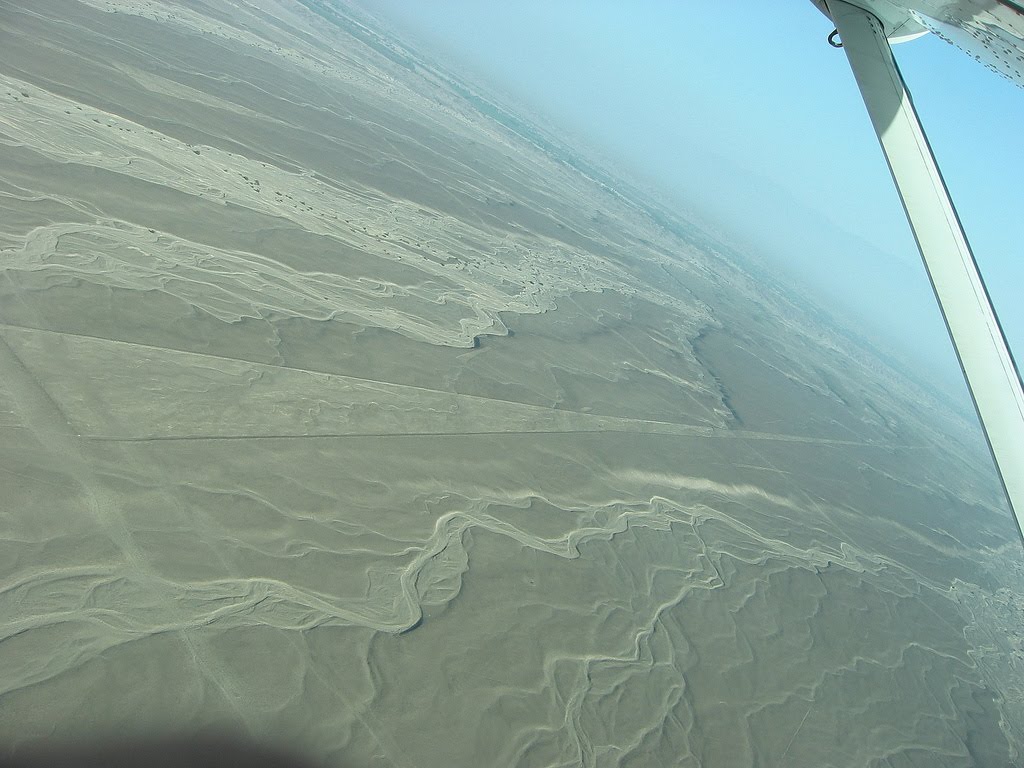
The Nazca Lines are located in the Nazca Desert, a high arid plateau that stretches between the towns of Nazca and Palpa on the pampa (a large flat area of southern Peru). The desolate plain of the Peruvian coast which comprises the Pampas of San Jose (Jumana), Socos, El Ingenio and others in the province of Nasca, is 400 Km. South of Lima, covers an area of approximately 450 km2, of sandy desert as well as the slopes of the contours of the Andes. They cover nearly 400 square miles of desert. Etched in the surface of the desert pampa sand about 300 hundred figures made of straight lines, geometric shapes most clearly visible from the air.

Nazca Plain

The Nazca plain is virtually unique for its ability to preserve the markings upon it, due to the combination of the climate (one of the driest on Earth, with only twenty minutes of rainfall per year) and the flat, stony ground which minimises the effect of the wind at ground level. With no dust or sand to cover the plain, and little rain or wind to erode it, lines drawn here tend to stay drawn. These factors, combined with the existence of a lighter-colored subsoil beneath the desert crust, provide a vast writing pad that is ideally suited to the artist who wants to leave his mark for eternity.

The pebbles which cover the surface of the desert contain ferrous oxide. The exposure of centuries has given them a dark patina. When the gravel is removed, they contrast with the color underneath. In this way the lines were drawn as furrows of a lighter color, even though in some cases they became prints. In other cases, the stones defining the lines and drawings form small lateral humps of different sizes. Some drawings, especially the early ones, were made by removing the stones and gravel from their contours and in this way the figures stood out in high relief.

The concentration and juxtaposition of the lines and drawings leave no doubt that they required intensive long-term labor as is demonstrated by the stylistic continuity of the designs, which clearly correspond to the different stages of cultural changes.

Nazca Lines - Enigmatic Designs

There appear to be various designs consisting of figures of animals, flowers and plants, objects, and anthropomorphic figures of colossal proportions made with well-defined lines. An example of this is the drawing of a weird being with two enormous hands, one normal and the other with only four fingers.

Also represented are drawings of man-made objects such as yarn, looms and "tupus" (ornamental clasps). All these figures have well-defined entrances which could be used as paths or to allow people to line together along the conformations of the drawings.

The anthropomorphic figures are relatively few and are situated on the slopes. The most well-known being is The Astronaut at 32m length discovered by Eduardo Herran in 1982.

The lines are many kilometers long and crisscross sectors of the pampas in all directions. Many of the lines form geometric figures: angles, triangles, bunches, spirals, rectangles, wavy lines, concentric circles.

Composition

The Lines were allegedly made by removing the iron-oxide coated pebbles which cover the surface of the desert. When the gravel is removed, they contrast with the light color underneath. In this way the lines were drawn as furrows of a lighter color. Off the Pampa, south of the Nazca Lines, archaeologists have now uncovered the lost city of the line-builders, Cahuachi. It was built nearly 2,000 years ago and mysteriously abandoned 500 years later.

Discovering the Nazca Lines by Outsiders

The Nazca Lines were first spotted when commercial airlines began flying across the Peruvian desert in the 1920's. Passengers reported seeing 'primitive landing strips' on the ground below. Today people sometimes fly in hot air balloons to view the splendors of the Nazca Lines, their eneries awakening something within their souls.

Preserving the Nazca Lines

It is difficult to keep the Nazca Lines free from outside intervention. As with all ancient ruins, such as Machu Piccu, weather by wind and rain, and human tampering will take their toll on these ancient Lines.

In recent years the Nazca Lines have suffered gradual destruction, as tomb raiders seeking pre-Inca artifacts scar the terrain with hundreds of burrows, garbage, among other waste material. A boom in copper and gold mining - including a mine built in 1997 a few feet from a 2,000-year-old, two-mile-long trapezoid -- is defacing parts of the Nazca Lines with tracks from truck traffic.

Over the past decade, advertisers and political campaigns have carved huge messages in the rock and sand between the ancient designs in this region 250 miles south of Lima.

In 1998, floods and mudslides from the El Nino weather pattern seriously eroded several figures.

As electricity reaches the growing local population, utility companies are running power cables over and around the site.

The damage to the Lines underscores Peru's desperate struggle to preserve its national patrimony. Archaeologists say they are watching helplessly as the quest for scholarship and conservation in a country viewed as the cradle of New World civilization is losing out to commercial interests, bleak poverty and the growing popularity of heritage sites as tourist attractions.

Theories

Toribio Mejia Xespe, a Peruvian doctor and anthropologist was the first scientist, in 1927, to show interest in what he called "great Incan ceremonial artifacts".

Michael Coe believes the Nazca Lines are sacred paths to walk by specific rites. The primary lines were an offering for elders, heaven, and mountain deities who gave them water for their fields.

Erich von Daniken suggested, in his 1968 book, Chariots of the Gods, that the lines were built by ancient astronauts as a landing strip. But the soft clay soil and layer of brown and black rocks in the Nazca desert would seem an unsuitable site for landing and were blown away by the power of rocket propulsion. The aliens left - never to return - leaving the people confused. Like in the modern cargo cults they tried to call the Gods back by drawing lines, figures and trapezes.

Robin Edgar beieved that the Nazca Figures were inspired by, and intended to be seen by, the (so-called) Eye of God that is manifested during total solar eclipses. An extraordinary series of solar eclipses coincided with the construction of the Nasca lines. Some Lines are aligned with the winter solstice, a less spectacular but more regular, death and rebirth of the Sun God.

The Code of Carl Munck - The Ancient Geomatria of Numbers --The Nazca Line ground markings locate themselves on The Code Matrix system. Nazca Lines and Archaeocryptography The ancient sites around the world are very precisely positioned on a global coordinate system in relation to the position of the Great Pyramid at Giza. The positions of the sites are given in the geometry of their construction. A very ancient system of numbers was used in the system, which we will call Gematria. Gematrian numbers are found in ancient myths and religions, including the Bible. Gematrian numbers were used in systems of weights and measures by ancient peoples, including the Greeks, the Egyptians, the Persians, the Babylonians and the Romans. The Code system uses mathematical constants, such as pi and the radian. The system also uses conventions that are still in use, such as the 360 degree circle, 60 minute degree, 60 second minute, the base-ten numbering system, the 12-inch foot, and the 5280-foot mile.
The ancient Mayans used Gematrian numbers in their very accurate timekeeping.

Maria Reiche was a German mathematician and archaeologist who was famous for researching the Nazca Lines. She believed the lines were an Astronomical Calendar indicating the direction of the rising of important stars and planetary events like sun solstices. Formations like the spider and the monkey could show star constellations like Orion and Ursa Mayor. The problem with all astronomical theories is the unknowing of the age. The direction of stars changes within centuries, explained by the precession of the equinoxes.

Reiche led a determined effort to discredit theories of extraterrestrial visitors. She argued that the Nazca Indians constructed the Lines some time between 300 BC and AD 800. In support of this possibility, some scientists have put forward ingenious ideas on how the geoglyphs could theoretically have been designed from the ground. The more important evidence, however, is that which attempts to link the Lines definitively to the Nazcan culture. Here, neither of the two key pieces of evidence survive close scrutiny.

The first piece of evidence is a series of radiocarbon dates, based on ceramic and wood remains which were left at the Lines by the Nazca people. It is claimed that this proves that the Nazcans constructed the Lines. On the contrary, the dating of these materials tells us only that the Nazcans lived in the area of the Nazca Lines. Since the Lines themselves cannot be radiocarbon dated, the possibility remains that they already existed when the Nazcan culture emerged. The second piece of evidence is the alleged resemblance of the Nazca geoglyphs to certain features found on Nazca pottery. This is an important issue because it potentially offers proof that the Nazcans had either designed the images or at least viewed them from the air. Maria Reiche died in 1998 at the age of 95. She is buried in the arid valley she loved so well.

Professor Gerald Hawkins and his group went to Nazca to prove the astronomical Theory of Maria Reiche but was unsuccessful. In 1968, a study by the National Geographic Society determined that, while some of the Nazca lines did point to the positions of the Sun, Moon and certain stars two thousand years ago, it was no more than could be expected by mere chance. In 1973, Dr Gerald Hawkins studied 186 lines with a computer program and found that only 20 per cent had any astronomical orientation - again no more than by pure chance.

Simone Waisbard stated that the drawing of Nazca are a giant astronomical calendar. Further the Nazca-line-system was used to measure the precipitation value. Figures, especially seabirds, have a connection to the meteorological prophecy system of the Nazca-Culture. Her ideas for the trapezoid formations: places for holy animals before sacrifice them, or field claims connected with filter galleries, observatories or places for ritual ceremonies of the different clans.

Alan F. Alford concluded that the Nazca-Lines was made by Negroid Slaves of the Tihuanaco Culture. After a revolution the Negroid population destroyed some figure, this is the explanation for overdrawn zigzag-formations. Later this people went in northern direction and founded Chavin and the Olmec culture.

Robert Bast linked the lines to the Flood Stories in his book A Memory of the Deluge. The animal, plant and human-shaped figures are lying together on the ground as a memorial place of the big flood.

Gilbert de Jong wrote A Nazcan Zodiac. He traveled to Nazca and measured the GGF by GPS. He obtained a length of the square side of about 54,7 Meter. In the formation he recognized a Zodiac.

Markus Reindel's Dowsing Theory says that the Nazca Figures are markers for a subterranean waterflow. Trapezoides show the broadness of the waterstream, zigzaglines show where they end, lines show into direction of the puquitos. He explain the nature of the figures by rod-dowsing (to find the subterranean water) and shamanstic flights (to overview the figures).

Ellie's Theories

The Nazca lines seem to depict various kingdoms: Man, Aquatic, Avian, Beasts, among others that almost depict a blueprint of the journey on humanity in the alchemy of time. The major Nazca Lines follow the universal archetypes found throughout the world. I do not see them as a landing strip for returning space ships and creator gods, who have promised every civilization they will return, but never will.

As human consciousness is going through a process of evolution - the lines are one of many reminders and triggers of who we are and where we are going. Creation is part of a geometric blueprint that repeats in cycles of time created by the same consciousness. The key is scared geometry and understanding the holographic nature of our reality. The Nazca Lines will remain an enigma till the end of time along with other tangible objects placed here to awaken us.

Found Here: http://www.crystalinks.com/nazca.html