 The Nazca Lines are a series of ancient geoglyphs located in the Nazca Desert of Peru. They have been designated a UNESCO World Heritage Site. The high, arid plateau stretches more than 80 kilometres (50 mi) between the towns of Nazca and Palpa on the Pampas de Jumana. Although some local geoglyphs resemble Paracas motifs, scholars believe the Nazca Lines were created by the Nazca culture between 400 and 650 AD.[1] The hundreds of individual figures range in complexity from simple lines to stylized hummingbirds, spiders, monkeys, fish, sharks or orcas, llamas, and lizards.
 The lines are shallow designs made in the ground by removing the ubiquitous reddish pebbles and uncovering the whitish ground beneath. Hundreds are simple lines or geometric shapes; more than seventy are designs of animal, bird, fish or human figures. The largest figures are over 200 metres (660 ft) across. Scholars differ in interpreting the purpose of the designs, but they generally ascribe religious significance to them, as they were major works that required vision, planning and coordination of people to achieve.
The geometric ones could indicate the flow of water or be connected to rituals to summon water. The spiders, birds, and plants could be fertility symbols. Other possible explanations include: irrigation schemes or giant astronomical calendars.[2]
Due to the dry, windless and stable climate of the plateau and its isolation, for the most part the lines have been preserved. Extremely rare changes in weather may temporarily alter the general designs.
Construction
Scholars have theorized the Nazca people could have used simple tools and surveying equipment to construct the lines. Studies have found wooden stakes in the ground at the end of some lines, which support this theory. One such stake was carbon-dated and the basis for establishing the age of the design complex. Researcher Joe Nickell of the University of Kentucky has reproduced the figures by using tools and technology available to the Nazca people and which National Geographic referred to as "remarkable in its exactness" when compared to the actual lines.[3] With careful planning and simple technologies, a small team of people could recreate even the largest figures within days, without any aerial assistance.[4]
The lines were made by removing the reddish-brown iron oxide-coated pebbles that cover the surface of the Nazca desert. When the gravel is removed, the light-colored earth beneath shows in lines of sharply contrasting color and tone. The Nazca drew several hundred simple curvilinear animal and human figures by this technique. In total, the earthwork project is huge and complex: the area encompassing the lines is nearly 500 square kilometres (190 sq mi), and the largest figures can span nearly 270 metres (890 ft). The extremely dry, windless, and constant climate of the Nazca region has preserved the lines well. The Nazca desert is one of the driest on Earth and maintains a temperature around 25 °C (77 °F) all year round. The lack of wind has helped keep the lines uncovered and visible to the present day.

 Purpose
Archeologists, ethnologists and anthropologists have studied the ancient Nazca culture and the complex to try to determine the purpose of the lines and figures. One theory is that the Nazca people created them to be seen by their gods in the sky. Kosok and Reiche advanced a purpose related to astronomy and cosmology: the lines were intended to act as a kind of observatory, to point to the places on the distant horizon where the sun and other celestial bodies rose or set. Many prehistoric indigenous cultures in the Americas and elsewhere constructed earthworks that combined such astronomical sighting with their religious cosmology, as did the later Mississippian culture at Cahokia in present-day United States. Another example is Stonehenge in England. But, Gerald Hawkins and Anthony Aveni, experts in archaeoastronomy, concluded in 1990 that there was insufficient evidence to support such an astronomical explanation.[5]
In 1985, the archaeologist Johan Reinhard published archaeological, ethnographic, and historical data demonstrating that worship of mountains and other water sources predominated in Nazca religion and economy from ancient to recent times. He theorized that the lines and figures were part of religious practices involving the worship of deities associated with the availability of water, which directly related to the success and productivity of crops. He interpreted the lines as sacred paths leading to places where these deities could be worshiped. The figures were symbols representing animals and objects meant to invoke the gods' aid in supplying water. But, the precise meanings of many of the individual geoglyphs remain unsolved as of 2010.
Henri Stierlin, a Swiss art historian specializing in Egypt and the Middle East, published a book in 1983 linking the Nazca Lines to the production of ancient textiles which archeologists have found wrapping mummies of the Paracas culture.[6] He contended that the people may have used the lines and trapezes as giant, primitive looms to fabricate the extremely long strings and wide pieces of textile that are typical of the area. By his theory, the figurative patterns (smaller and less common) were meant only for ritualistic purposes.

.jpg) Alternative Theories
Alternative Theories
Some individuals propose alternative theories. Jim Woodmann believes that the Nazca Lines could not have been made without some form of manned flight to see the figures properly. Based on his study of available technology, he suggests that a hot air balloon was the only possible means of flight. To test this hypothesis, Woodmann made a hot-air balloon using materials and techniques which he understood were available to the Nazca people. The balloon flew, after a fashion. Most scholars have rejected Woodmann's thesis,[4] because of the lack of any evidence of such balloons.[7]
Swiss author Erich von Däniken suggests the Nazca lines and other complex constructions represent higher technological knowledge than he believes existed when the glyphs were created. Von Däniken maintains that the Nazca lines in Peru are runways of an ancient airfield that served beings from another culture.
Maria Reiche's protege Phillis Pitluga, an astronomer at the Adler Planetarium & Astronomy Museum, believes, based on computer aided studies of star alignments, that the giant spider figure is an anamorphic diagram of the constellation Orion. She further suggests that three of the straight lines leading to the figure were used to track the changing declinations of the three stars of Orion's Belt but does not take into account the other twelve lines. Aveni has commented on her work, saying
I really had trouble finding good evidence to back up what she contended. Pitluga never laid out the criteria for selecting the lines she chose to measure, nor did she pay much attention to the archaeological data Clarkson and Silverman had unearthed. Her case did little justice to other information about the coastal cultures, save applying, with subtle contortions, Urtons representations of constellations from the highlands. As historian Jacquetta Hawkes might ask: was she getting the pampa she desired?[8]
Found Here: http://en.wikipedia.org/wiki/Nazca_Lines
Stretching across the Nazca plains like a giant map or blueprint left by ancient astronauts, lie the famous Nazca Lines of Peru. Peru is associated with the Inca Civilization.
The Nazca Lines are an engima. No one has proof who built them or why. Since their discovery, the Nazca Lines have inspired fantastic explanations from ancient gods, a landing strip for returning aliens, a celestial calendar created by the ancient Nazca civilization -- putting the creation of the lines between 200 BC and 600 AD, used for rituals probably related to astronomy, to confirm the ayllus or clans who made up the population and to determine through ritual their economic functions held up by reciprocity and redistribution, or a map of underground water supplies.
There are also huge geoglyphs in Egypt, Malta, United States (Mississippi and California), Chile, Bolivia and in other countries. But the Nazca geoglyphs, because of their numbers, characteristics, dimensions and cultural continuity, were made and remade throughout the whole pre-hispanic period, forming a most impressive, as well as enigmatic, archeological group.

 Location
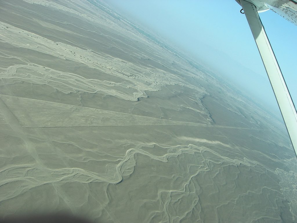
The Nazca Lines are located in the Nazca Desert, a high arid plateau that stretches between the towns of Nazca and Palpa on the pampa (a large flat area of southern Peru). The desolate plain of the Peruvian coast which comprises the Pampas of San Jose (Jumana), Socos, El Ingenio and others in the province of Nasca, is 400 Km. South of Lima, covers an area of approximately 450 km2, of sandy desert as well as the slopes of the contours of the Andes. They cover nearly 400 square miles of desert. Etched in the surface of the desert pampa sand about 300 hundred figures made of straight lines, geometric shapes most clearly visible from the air.
The Nazca plain is virtually unique for its ability to preserve the markings upon it, due to the combination of the climate (one of the driest on Earth, with only twenty minutes of rainfall per year) and the flat, stony ground which minimises the effect of the wind at ground level. With no dust or sand to cover the plain, and little rain or wind to erode it, lines drawn here tend to stay drawn. These factors, combined with the existence of a lighter-colored subsoil beneath the desert crust, provide a vast writing pad that is ideally suited to the artist who wants to leave his mark for eternity.
The pebbles which cover the surface of the desert contain ferrous oxide. The exposure of centuries has given them a dark patina. When the gravel is removed, they contrast with the color underneath. In this way the lines were drawn as furrows of a lighter color, even though in some cases they became prints. In other cases, the stones defining the lines and drawings form small lateral humps of different sizes. Some drawings, especially the early ones, were made by removing the stones and gravel from their contours and in this way the figures stood out in high relief.
The concentration and juxtaposition of the lines and drawings leave no doubt that they required intensive long-term labor as is demonstrated by the stylistic continuity of the designs, which clearly correspond to the different stages of cultural changes.
 Nazca Lines - Enigmatic Designs
There appear to be various designs consisting of figures of animals, flowers and plants, objects, and anthropomorphic figures of colossal proportions made with well-defined lines. An example of this is the drawing of a weird being with two enormous hands, one normal and the other with only four fingers.
Also represented are drawings of man-made objects such as yarn, looms and "tupus" (ornamental clasps). All these figures have well-defined entrances which could be used as paths or to allow people to line together along the conformations of the drawings.
The anthropomorphic figures are relatively few and are situated on the slopes. The most well-known being is The Astronaut at 32m length discovered by Eduardo Herran in 1982.
The lines are many kilometers long and crisscross sectors of the pampas in all directions. Many of the lines form geometric figures: angles, triangles, bunches, spirals, rectangles, wavy lines, concentric circles.
The Lines were allegedly made by removing the iron-oxide coated pebbles which cover the surface of the desert. When the gravel is removed, they contrast with the light color underneath. In this way the lines were drawn as furrows of a lighter color. Off the Pampa, south of the Nazca Lines, archaeologists have now uncovered the lost city of the line-builders, Cahuachi. It was built nearly 2,000 years ago and mysteriously abandoned 500 years later.
The Nazca Lines were first spotted when commercial airlines began flying across the Peruvian desert in the 1920's. Passengers reported seeing 'primitive landing strips' on the ground below. Today people sometimes fly in hot air balloons to view the splendors of the Nazca Lines, their eneries awakening something within their souls.
It is difficult to keep the Nazca Lines free from outside intervention. As with all ancient ruins, such as Machu Piccu, weather by wind and rain, and human tampering will take their toll on these ancient Lines.
In recent years the Nazca Lines have suffered gradual destruction, as tomb raiders seeking pre-Inca artifacts scar the terrain with hundreds of burrows, garbage, among other waste material. A boom in copper and gold mining - including a mine built in 1997 a few feet from a 2,000-year-old, two-mile-long trapezoid -- is defacing parts of the Nazca Lines with tracks from truck traffic.
Over the past decade, advertisers and political campaigns have carved huge messages in the rock and sand between the ancient designs in this region 250 miles south of Lima.
In 1998, floods and mudslides from the El Nino weather pattern seriously eroded several figures.
As electricity reaches the growing local population, utility companies are running power cables over and around the site.
The damage to the Lines underscores Peru's desperate struggle to preserve its national patrimony. Archaeologists say they are watching helplessly as the quest for scholarship and conservation in a country viewed as the cradle of New World civilization is losing out to commercial interests, bleak poverty and the growing popularity of heritage sites as tourist attractions.
 Theories
 Toribio Mejia Xespe, a Peruvian doctor and anthropologist was the first scientist, in 1927, to show interest in what he called "great Incan ceremonial artifacts".
Michael Coe believes the Nazca Lines are sacred paths to walk by specific rites. The primary lines were an offering for elders, heaven, and mountain deities who gave them water for their fields.
Erich von Daniken suggested, in his 1968 book, Chariots of the Gods, that the lines were built by ancient astronauts as a landing strip. But the soft clay soil and layer of brown and black rocks in the Nazca desert would seem an unsuitable site for landing and were blown away by the power of rocket propulsion. The aliens left - never to return - leaving the people confused. Like in the modern cargo cults they tried to call the Gods back by drawing lines, figures and trapezes.
Robin Edgar beieved that the Nazca Figures were inspired by, and intended to be seen by, the (so-called) Eye of God that is manifested during total solar eclipses. An extraordinary series of solar eclipses coincided with the construction of the Nasca lines. Some Lines are aligned with the winter solstice, a less spectacular but more regular, death and rebirth of the Sun God.
The Code of Carl Munck - The Ancient Geomatria of Numbers --The Nazca Line ground markings locate themselves on The Code Matrix system. Nazca Lines and Archaeocryptography The ancient sites around the world are very precisely positioned on a global coordinate system in relation to the position of the Great Pyramid at Giza. The positions of the sites are given in the geometry of their construction. A very ancient system of numbers was used in the system, which we will call Gematria. Gematrian numbers are found in ancient myths and religions, including the Bible. Gematrian numbers were used in systems of weights and measures by ancient peoples, including the Greeks, the Egyptians, the Persians, the Babylonians and the Romans. The Code system uses mathematical constants, such as pi and the radian. The system also uses conventions that are still in use, such as the 360 degree circle, 60 minute degree, 60 second minute, the base-ten numbering system, the 12-inch foot, and the 5280-foot mile.
The ancient Mayans used Gematrian numbers in their very accurate timekeeping.
 Maria Reiche was a German mathematician and archaeologist who was famous for researching the Nazca Lines. She believed the lines were an Astronomical Calendar indicating the direction of the rising of important stars and planetary events like sun solstices. Formations like the spider and the monkey could show star constellations like Orion and Ursa Mayor. The problem with all astronomical theories is the unknowing of the age. The direction of stars changes within centuries, explained by the precession of the equinoxes.
Reiche led a determined effort to discredit theories of extraterrestrial visitors. She argued that the Nazca Indians constructed the Lines some time between 300 BC and AD 800. In support of this possibility, some scientists have put forward ingenious ideas on how the geoglyphs could theoretically have been designed from the ground. The more important evidence, however, is that which attempts to link the Lines definitively to the Nazcan culture. Here, neither of the two key pieces of evidence survive close scrutiny.
The first piece of evidence is a series of radiocarbon dates, based on ceramic and wood remains which were left at the Lines by the Nazca people. It is claimed that this proves that the Nazcans constructed the Lines. On the contrary, the dating of these materials tells us only that the Nazcans lived in the area of the Nazca Lines. Since the Lines themselves cannot be radiocarbon dated, the possibility remains that they already existed when the Nazcan culture emerged. The second piece of evidence is the alleged resemblance of the Nazca geoglyphs to certain features found on Nazca pottery. This is an important issue because it potentially offers proof that the Nazcans had either designed the images or at least viewed them from the air. Maria Reiche died in 1998 at the age of 95. She is buried in the arid valley she loved so well.
Professor Gerald Hawkins and his group went to Nazca to prove the astronomical Theory of Maria Reiche but was unsuccessful. In 1968, a study by the National Geographic Society determined that, while some of the Nazca lines did point to the positions of the Sun, Moon and certain stars two thousand years ago, it was no more than could be expected by mere chance. In 1973, Dr Gerald Hawkins studied 186 lines with a computer program and found that only 20 per cent had any astronomical orientation - again no more than by pure chance.
 Simone Waisbard stated that the drawing of Nazca are a giant astronomical calendar. Further the Nazca-line-system was used to measure the precipitation value. Figures, especially seabirds, have a connection to the meteorological prophecy system of the Nazca-Culture. Her ideas for the trapezoid formations: places for holy animals before sacrifice them, or field claims connected with filter galleries, observatories or places for ritual ceremonies of the different clans.
Alan F. Alford concluded that the Nazca-Lines was made by Negroid Slaves of the Tihuanaco Culture. After a revolution the Negroid population destroyed some figure, this is the explanation for overdrawn zigzag-formations. Later this people went in northern direction and founded Chavin and the Olmec culture.
Robert Bast linked the lines to the Flood Stories in his book A Memory of the Deluge. The animal, plant and human-shaped figures are lying together on the ground as a memorial place of the big flood.
Gilbert de Jong wrote A Nazcan Zodiac. He traveled to Nazca and measured the GGF by GPS. He obtained a length of the square side of about 54,7 Meter. In the formation he recognized a Zodiac.
Markus Reindel's Dowsing Theory says that the Nazca Figures are markers for a subterranean waterflow. Trapezoides show the broadness of the waterstream, zigzaglines show where they end, lines show into direction of the puquitos. He explain the nature of the figures by rod-dowsing (to find the subterranean water) and shamanstic flights (to overview the figures).
The Nazca lines seem to depict various kingdoms: Man, Aquatic, Avian, Beasts, among others that almost depict a blueprint of the journey on humanity in the alchemy of time. The major Nazca Lines follow the universal archetypes found throughout the world. I do not see them as a landing strip for returning space ships and creator gods, who have promised every civilization they will return, but never will.
As human consciousness is going through a process of evolution - the lines are one of many reminders and triggers of who we are and where we are going. Creation is part of a geometric blueprint that repeats in cycles of time created by the same consciousness. The key is scared geometry and understanding the holographic nature of our reality. The Nazca Lines will remain an enigma till the end of time along with other tangible objects placed here to awaken us.
Found Here: http://www.crystalinks.com/nazca.html


3 comments:
Looking surveying instruments in locality? Janak India one of the leading surveying equipment suppliers in Delhi, Noida. Janak has a wide range of surveying instruments, surveying equipment, positioning and surveying system and many more.
The line is deleted everywhere on the ground and expose the pale red pebbles under shallow ground design.
Tours in Nazca
waw! I know more about peru, may I quote for my homework about Mysterious Geoglyphs in Peru
Post a Comment